AERIAL LAND PHOTOGRAPHY
Land & Acreage Photography Jacksonville, FL
Land and acreage photography in Jacksonville, FL provides aerial images for vacant land, large parcels, rural properties, development sites, farms, estates, and other properties throughout Jacksonville and Northeast Florida. Aerial photography can help show property size, access points, surrounding areas, major site features, and the overall character of land that may be difficult to capture from ground level.
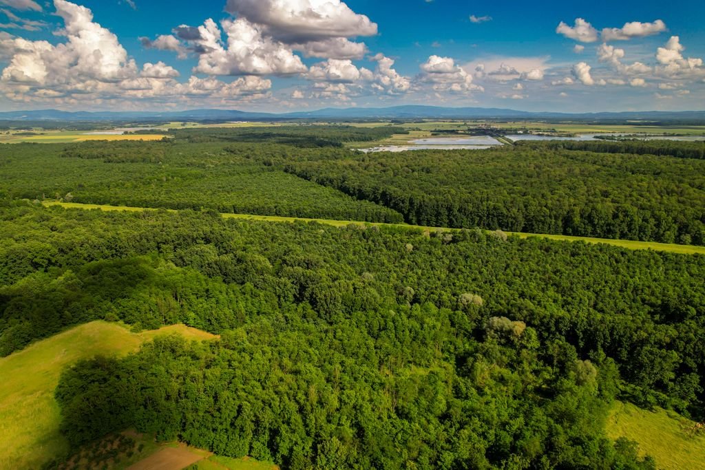
AERIAL IMAGERY FOR LAND & LARGE PROPERTIES
What Can Land & Acreage Photography Be Used For?
Land and acreage photography can help show the size, layout, access points, surrounding roads, terrain, structures, vegetation, and other major features of a property from above. Aerial images can provide context that is difficult to capture with ground-level photography alone.
Throughout Jacksonville and Northeast Florida, aerial photography may be useful for vacant land, rural properties, farms, estates, development sites, large residential parcels, and other properties where overall scale and surroundings matter. The type of imagery needed will depend on the property, intended use, location, and service availability.
Vacant Land Marketing
Aerial photography can help present vacant lots and undeveloped parcels by showing property size, surroundings, road access, nearby development, and major site features.
Large Parcel Visibility
Drone imagery can provide a broader view of acreage, estates, farms, rural properties, and other large sites that are difficult to understand from ground level.
Development & Site Context
Aerial images can help show access points, surrounding roads, neighboring properties, terrain, structures, and other features that may be useful for development or planning discussions.
Property & Estate Presentation
Professional aerial imagery can support property listings, marketing materials, presentations, websites, and other visual content for large or unique properties.
WHY USE LAND & ACREAGE PHOTOGRAPHY?
Show the Full Scale and Setting of a Property
Land and acreage photography can provide a broader view of large properties, helping show scale, access, surroundings, terrain, structures, and major site features more clearly. Aerial images can be especially useful when the size or setting of a property is difficult to understand from ground-level photos alone.
Show Size & Layout
Aerial photography can help viewers understand the overall scale, shape, and layout of land, acreage, estates, farms, and large parcels.
Strengthen Property Presentation Professional aerial imagery can make land listings, development presentations, websites, brochures, and other marketing materials more informative and visually engaging.
Provide Better Site Context
Drone images can show access roads, neighboring properties, surrounding development, terrain, vegetation, structures, and other important site features.
SERVING JACKSONVILLE & NORTHEAST FLORIDA
Land & Acreage Photography for Jacksonville-Area Properties
Land and acreage photography requests may be available throughout Jacksonville and surrounding Northeast Florida communities, including the Jacksonville Beaches, Ponte Vedra, St. Johns County, Clay County, Nassau County, and nearby areas. Availability can vary based on property location, airspace, weather, access, timing, and provider coverage.
Have land or acreage outside these areas? Contact us to check availability for your location.
LAND & ACREAGE PHOTOGRAPHY FAQ
READY TO GET STARTED?
Request Land and Acreage Photography in Jacksonville
Tell us about the property, location, and the type of aerial imagery you need. We’ll review the details and help connect you with a local drone professional based on project scope, timing, location, and service availability.
Commercial drone operations may be subject to FAA rules and applicable airspace requirements. https://www.faa.gov/uas