CONSTRUCTION AERIAL PHOTOGRAPHY
Construction Progress Photography Jacksonville, FL
Construction progress photography in Jacksonville, FL provides aerial images that help builders, contractors, developers, property managers, and project teams document job sites, milestones, and changing site conditions throughout Jacksonville and Northeast Florida. Drone photography can provide a broader visual record of construction activity, site development, completed work, and overall project progress.
AERIAL DOCUMENTATION FOR ACTIVE PROJECTS
What Can Construction Progress Photography Be Used For?
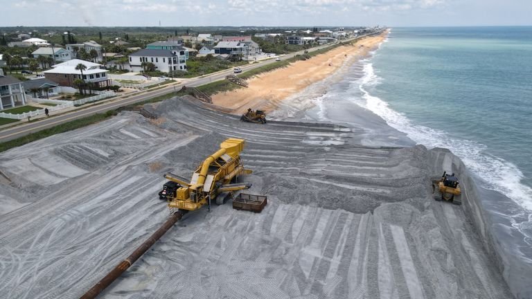
Construction progress photography can help create a clear visual record of how a project changes over time. Aerial images can show site conditions, completed work, access areas, equipment placement, building progress, surrounding development, and major milestones from a broader perspective than ground-level photos alone.
Throughout Jacksonville and Northeast Florida, builders, contractors, developers, property managers, and project teams may use recurring drone photography to support project updates, internal documentation, stakeholder communication, marketing, and visual progress records. The type and frequency of imagery needed will depend on the project scope, schedule, location, and service availability.
Milestone Documentation
Capture aerial images at key stages of construction to create a visual record of major project milestones and completed work.
Recurring Progress Updates
Scheduled drone photography can help document how a job site changes over time and provide consistent visual updates throughout the life of a project.
Site Overview & Development
Aerial images can show the overall project layout, access points, staging areas, surrounding development, and changing site conditions from a broader perspective.
Stakeholder & Project Reporting
Progress imagery can support internal updates, client communication, presentations, marketing, and other project reporting needs.

WHY USE CONSTRUCTION PROGRESS PHOTOGRAPHY?
Keep a Clear Visual Record of Your Project
Construction progress photography can provide a consistent visual record of a project from above, helping teams see changes, completed work, site conditions, and overall development more clearly. Aerial images can support communication, documentation, and project updates throughout the construction process.
Document Progress Over Time
Recurring aerial photography can help create a visual timeline of construction activity, site changes, and completed milestones.
Improve Project Visibility
Aerial images can provide a broader view of the job site, helping project teams, clients, and stakeholders better understand overall progress and site conditions.
Support Updates & Reporting
Construction progress images can be useful for client updates, internal reporting, presentations, marketing, and project documentation.
SERVING JACKSONVILLE & NORTHEAST FLORIDA
Construction Progress Photography for Jacksonville-Area Projects
Construction progress photography requests may be available throughout Jacksonville and surrounding Northeast Florida communities, including the Jacksonville Beaches, Ponte Vedra, St. Johns County, Clay County, Nassau County, and nearby areas. Availability can vary based on project location, airspace, weather, site access, timing, and provider coverage.
Have a project outside these areas? Contact us to check availability for your location.
CONSTRUCTION PROGRESS PHOTOGRAPHY FAQ
READY TO GET STARTED?
Request Construction Progress Photography in Jacksonville
Tell us about your construction project, location, preferred schedule, and the type of progress imagery you need. We’ll review the details and help connect you with a local drone professional based on project scope, timing, location, and service availability.
Commercial drone operations may be subject to FAA rules and applicable airspace requirements. https://www.faa.gov/uas